Mc. Carthy, Alaska

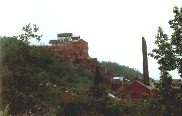
MC. CARTHY, JULY 1997 Alaska is the land of the goldrush.  Nowadays, the real goldmines are all but a few little ones closed.  Now black gold is the primary treasure, as is illustrated by the Alaska pipeline you encounter along the road on several occasions.  Deep into the Wrangell mountains, in the beginning of the 20th centrury, a mountain of copper was discovered.  This was the foundation of the little mine town Kennicott and the village of Mc. Carthy.  The only connection with the civilised word was the railroad, used to transport the copper. 

The train left Kennicott for the last time in november 1938.  People that wanted to leave the wilderness could come along. There was no time to pack a lot.  This created the ghost town of Kennicott, which is now pretty much like back in 1938.
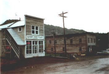
Chitina, begining of the Mc. Carthy road

The rails were removed later and the railroad was filled up with gravel.  This is now the only road to go to Mc Carthy.  The road starts in Chitina, the last ‘village’ of the civilised world (only a couple of wooden houses) .  From there on, for about 100 km, look out for iron bars and nails used to hold the rails sticking out of the road, as heavy rains and melting ice bring them constantly back to the surface.  You don’t want to have more than one flat tire over here – next to the road one finds now and then an abandoned car wreck. This trip took us more than 6 hours and we stopped to collect 14 nails (which are about 15 cm long)… But it was the trip of a lifetime, it’s really going into the wilderness.  We crossed magnificient rivers and the sight of the Wrangell mountains was fantastic.  The railroad bridges used to be scary to cross by car (wooden planks missing and no fence) but this is not the case anymore, since the end of the eighties they are ‘modernised’.

End of the road, there’s only a parking lot and a camping area.  To go to Mc. Carthy, the only way is by foot, as you have to cross the river – there are only a few cars in Mc. Carthy, brought there in winter when the river is frozen.  There used to be a cable crossing the river with a ‘tram’ attached to it (and you had to operate it yourself, manually).  This is now history, the cable was still there in 1997, but the ‘tram’ was not operational anymore since a few years.  There now is an (ugly) iron foot bridge.  The real goldmine for Mc. Carthy is now tourism.  And the guys just before the footbridge are the first to sell you tickets for mountain bike tours, glacier tours, plane trips, nature walks,…  On the campsite, there is no running water, no sanitary facilities, no electricity… this is close to the real wilderness experience.
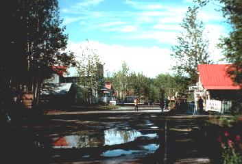
Mc. Carthy village Kennicott mine town

The Mc. Carthy village is pretty much like it used to be, albeit ‘adapted’ to tourism demands.  The lodge and the hotel are both ‘old style’.  The lodge has a sign “showers”, which is more than welcome after a few days, but showers are only possible in the evening and you have to bring your towel.  Entering the lodge, there is also a sign asking visitors ‘to declare their guns at the bar’.  Drinks are expensive, but what did you expect… ? The pizza house next to the hotel sells ‘the best pizza in America’, and I can tell you this is not a very big overstatement.

A trip to the Kennicott mine village, some miles further, is even more like going back into time. Half of the buidings and houses show clear signs of decay, the other half is being repared gradually.  You can enter the houses, but not the old mine – since this is dangerous, it’s only possible with a guided visit. There used to live several hundreds mine workers here.  Now a real ghost town.  The debris of the copper mine activities are still there, large piles of rock.  Not to be confused with the morenes (huge !) of nearby Root glacier. Drinking a cup of coffee in the ‘Kennicott Glacier Lodge’ can help your imagination going back into time.

I’ve also done some mountain biking and glacier walking (see next story) during the couple of days I was in this fantastic area.  It was hard to go back to civilisation after a few days…

Posted in Hiking | Tagged , | Comments Off

Denali basecamp, Alaska

TALKEETNA, JULY 1997 Seeing Mount Mc. Kinley was one of the things I dreamt about before coming to Alaska.  Native Americans used to call this mountain ‘Denali’ (‘the great one’).  The name is absolutely appropriate – with its 6194 meters this mountain is not only  the highest in North-America, measured from the lowlands that surround it, it has a vertical relief considered being the highest in the world, even higher than that of Mt. Everest. 

“Wow, this must be an awesome sight”, I thought, already in dreams standing on the grassy lowland looking up to the mountain… There’s only one little warning : you have to be lucky to see it.  Chances seeing this giant are one out of three, at other times there’s nothing but clouds.

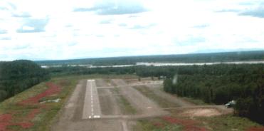
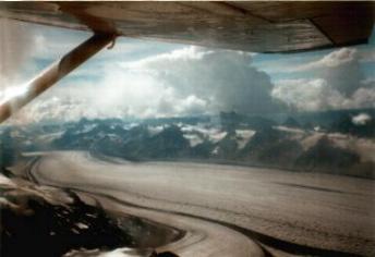
I was lucky to see a glimpse of the mountain top during a plane flight – later in the Denali N.P. the mountain did not show it’s grandeur anymore to us…  From the town of Talkeetna, there are several companies offering a trip of half an hour to a couple of hours with a small Cesna-like plane.  Such a flight is a true adventure.  Taking off from the ‘landing strip’ (and landing hopefully) is quite ‘bumpy’ and sometimes the ‘runway’ is made of gravel.  The little plane brings you above tundra landscapes with glacier rivers, across huge glaciers and between the peaks of the Denali mountain range.  It’s really spectacular and sometimes you wonder how the pilot manages to fly over some peaks or fails not to touch the rocks when flying through some small passages.

The landing strip

Ruth Glacier

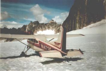
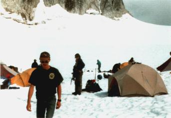
I took a trip with included glacier landing to a place near the basecamp mountaineers use to climb Mt. Mc Kinley.  The landing is not always possible as the plane must be able to take off again (the snow that covers the glacier the plane lands on, must be solid enough).  Our pilot decided he could manage but only when using the ‘skis’. When we had landed, we could wander around a little to go and visit a camp made by mountain climbers, which were practicing mountain survival skills.  They were brought up here by plane, but would have to hike down again as glacier landing would not be possible anymore soon, when mid-summer arrived.

Glacier Landing

Mountaineering camp


Posted in Hiking, iconic mountains | Tagged , , | Comments Off

Rochers de Naye, Swiss Alps

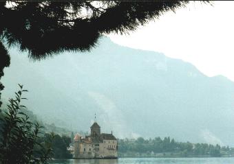
MONTREUX, AUGUST 2001 – The railway going from Geneva to Montreux follows the borders of the Geneva lake.  After a short visit to the beautiful town of Lausanne, with presumably one of the nicest cathedrals of Switzerland, we went on to Montreux, to visit the world famous ‘Chillon castle’ and to get away for a couple of hours into the mountains.  The Chillon castle, built on a rock in the Geneva lake, seems kind of small when seen from a distance, but when visiting the numerous rooms, cellars, passways and towers, it becomes soon clear this is an immense fortress.  In the past many of its visitors have fallen in love with the castle and its surroundings, among them Lord Byron which has put his name on one of the pillars in the former prisoner cells.  

The wooden passways, that used to be manned by the guards defending this castle, now constantly crack under the burden of the many tourists from all over the world.

Chillon Castle

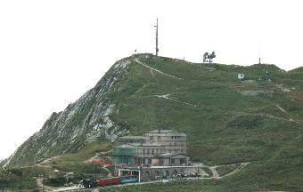
From the station of Teritet, about a 15 minutes walk from the Chillon castle, a fully automated cable car takes you in 4 minutes time to the station of Glion, from where you can admire the castle once again, now surrounded by views of the mountains.  To be able to really admire the Alps however, we had to go higher, up to a place called ‘Rochers de Naye’, at an altitude of 2041 metres.  The pinion railway train takes you there, a ride that is maybe the most expensive I’ve ever taken but it’s a real adventure and worth every Euro !  Moreover at the very end of the ride, you are on top of Rochers de Naye, and from there the views are absolutely stunning.  On the top, we visited the Alpine garden, which hosts a collection of mountain flowers from the Alps (e.g. the Edelweiss) but also from elsewhere in the world (Himalayas, Andes,…).

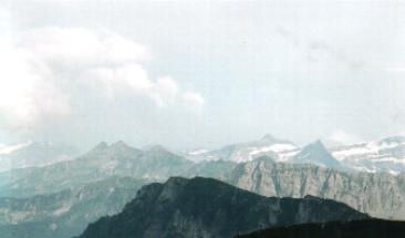
Rochers de Naye train station Look this way for Eiger !

What struck me the most was the fast changing landscape.  The many clouds that were there that day played with the sun and the shadows on the mountains, resulting each time in a different scenery.  When it’s clear you can see the Eiger from up here. The bells of the Alpine cows are the only music that is heard here.  Yet another discovery, a small concrete Tibetan chörten – Switzerland hosts the most Tibetan refugees next to India.  We walked around for some hours and saw the lakeside view disappear completely in the mist.  By the time we heard the last train came up to bring us down again, the mist had reached the train station.  But the trip was not over yet.  By the time we reached Glion again, it was raining but we nevertheless decided to walk back to Montreux. It’s an easy path to follow but in rainy conditions, it’s very slippery.  This was a descent some of us will remember for a long time…

We went into Montreux town for diner, admiring the thunder and lighting raging above the lake, from in between the palm trees on a lakeside terasse.  We were all a little tired but yet another experience richer.

Posted in Hiking | Tagged , , | Comments Off

Obergurgl, Austrian Alps

OBERGURGL, JULY 1996 Most people in Europe visit the Alps in France, Austria, Italy or Switzerland in winter on their ski break.  I visited the Alps in mid summer and even then you encounter snow, provided that you go high enough. Obergurgl is situated in Otztäl, in the Austrian Alps, at an elevation of 1930 metres.  No village in Austria is situated at higher altitude than this one, making it an ideal startpoint for hikes in the high Alpes nearby.  Many peaks of 3000 metres and up are situated in this area, including the Wildspitze, Austria’s highest mountain, rising 3772 metres above the wonderful alpine landscapes.

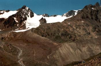
First goal of the hike was reaching the Breslauer Hütte, at an altitude of 2840 metres.  This is the startpoint for hikers that go up the Wildspitze.  I didn’t climb the Wildspitze – although this is not a technically difficult mountain, it should not be undertaken without a mountain guide. And most importantly, the weather is king of the mountains… the weather decides whether or not to go on a particular hike

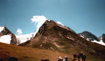
 View from the Breslauer HütteHappy hikers  


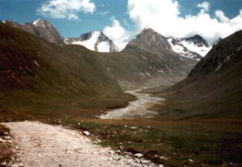
But I made another fantastic hike in the Vent area, crossing  mountain ridges and wonderful passes,… unforgettable mountain beauty !  From the Breslauer hütte,  I continued my hike to the Vernagthütte, a few more hours away from the Breslauer Hütte, located at 2766 metres.  The ups and downs on this hike are not much, as one walks on a the side of  mountain slope ranging between 2600 and 2900 metres,  the sights are magnificent !  Most of all, you are above the tree level here, there’s nothing but rocks, ice and snow – this is my favorite part of the mountains.  On the way back to the town of Vent, one descents quite gradually, and on the lower grassy meadows, sheep are a common sight.  Also spectacular is a hanging bridge over a river gorge, nearly at the end of this hike.

 Mountain beauty of the Alps When I arrived back in the village of Vent, drinking a beer (or a glass of butter milk if you prefer) was absolutely heavenly.  And while sitting on the terasse, you can still enjoy the splendors of the Austrian Alps…
Posted in Hiking | Tagged , , | Comments Off

Snowdon

Snowdon

Wales, 1085 m, visited July 2012

The highest mountain of Wales, in the Snowdonia N.P.  Multiple routes available to the top ranging from easy to challenging, the most scary being over a narrow ridge.  You can also take the train to the top – some of them are steam powered, a great sight when hiking ! Outstanding view on a clear day with many hills, lakes, the sea, Anglesey,…

There is also a yearly running competition !

Posted in Hiking, iconic mountains | Tagged | Comments Off

Skiddaw

Skiddaw

England, 931 m , visited July 2012.

The fourth highest mountain of the Lake district, missed the climb due to bad weather this time, have to go back to climb…

Posted in Hiking | Tagged | Comments Off

Latrigg

Latrigg

England, visited July 2012

An easy walkable hill from the centre of Keswick, Lake District.  A warmup to start the climb of Siddaw perhaps ?  Anyway, great views from the top, so very rewarding climb.  The climb takes you through a nice forest.

Posted in Hiking | Tagged | Comments Off

Catbells


Catbells

England, 451 m, visited July 2012

A not so impressive  hill , easily walkable from Keswick.  But very famous because of two reasons : it’s the hill you see from the well known Friars Crag viewpoint, and the view from its top is fabulous : Derwentwater, Skiddaw and Blencathra, and the Borrowdale valley to the other side…  The picture is taken from the top of Latrigg, another popular hill reachable from Keswick (Catbells is in front on the left).

Posted in Hiking | Tagged | Comments Off

Castle Crag

Castle Crag

England, visited July 2012.

Told to be one of the most beautiful viewpoints of the Lake District, the top of Castle Crag gives you a view of Skidaw, Scaffel Pike and Helvellyn , and many others, … on a clear day. We walked from Seatoller to the centre of Keswick, a wonderful walk in a very beautiful valley.  On the way we climbed Castle Crag, which was quite an adventure but not so difficult.  The clouds hid the best view but it was still very rewarding.

Posted in Hiking | Tagged | Comments Off

Helvellyn

Helvellyn

England, visited July 2012

After I had climbed Scafell Pike 20 years ago, I wanted to go back to the Lake District, and climb other peaks.  Helvellyn is a very popular mountain because of the access route via the Striding Edge, a sharp ridge walk to reach the top.  We chose the ‘easy’ way, starting from Swirls carpark near Wythburn.  This route is very streightforward bu you get to see all the spectacular views of Striding Edge and Swirling Edge, etc… We went down the other side, to reach Wythburn church.

Posted in Hiking | Tagged | Comments Off